![WPA Land use survey map for the City of Los Angeles, book 8 (Downtown Los Angeles and Hyde Park to Watts District), sheet 32 WPA Land use survey map for the City of Los Angeles, book 8 (Downtown Los Angeles and Hyde Park to Watts District), sheet 32. Includes: [Title page and] legend [for Book] no. Los Angeles homes maps rely on public layers, not private addresses](/covers/los-angeles-homes-map-1920.webp?v=31108572)
Maintenance
Los Angeles homes maps rely on public layers, not private addresses
The Los Angeles homes map is public: ZIMAS zoning, CAL FIRE hazard zones, fault and flood maps, SurveyLA — and never a pin on a private house.
The useful Los Angeles homes map is not a map of houses. It is a set of public maps that already exist, drawn by bodies with no interest in who lives where.
Terrain, street pattern, zoning, hazard overlays, historic surveys. Lay them over one another and the city's buildings explain themselves. No pin on any private house is needed, and none appears here.
This page shows how to read those layers. It identifies no residence, no occupant and no address.
Readers who come to Mansion Home Tours for celebrity homes, mansions and real estate can use these layers as background. They show why a ridge-top estate, a canyon house or a bluff-side mansion sits where it does, and why the same square footage can carry different values across the city.
The public layers also keep the focus on land, zoning and hazard conditions rather than private occupants. That context is what makes the home tours, mansion features and real estate coverage on this site easier to read.
What to take away
- Terrain is the first layer. Basin, foothill, canyon, ridge and coastal bluff each produce a distinct building, and the boundaries between them are visible on any topographic map.
- The street pattern records how each district was reached when it was built. Grid, contour curve and cul-de-sac are dates.
- Public planning and hazard mapsZIMAS for zoning, the California Geological Survey's fault and seismic hazard maps, FEMA's flood maps, the city's fire hazard severity zone — say what may be built and what conditions a building must meet. They are public, and they are the map that matters.
Start with the ground
The city sits on a coastal plain with the Santa Monica Mountains rising through its western half, cut by canyons, edged by the bluffs at Pacific Palisades, and crossed by the Los Angeles River, which was channeled in concrete long ago. Every one of those features has its own kind of house, and the transitions between them are sharp enough to walk across in a few minutes.
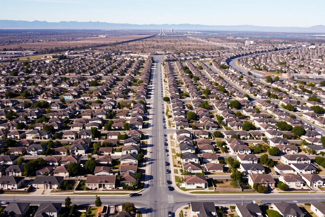
The basin. Flat or nearly flat, laid out on a grid, built on wide shallow lots. The houses are low, detached and spread sideways. This is the ground that produced the single-story pattern described in Los Angeles homes, and it is the largest share of the city by far.
The foothills. Where the grade begins — the lower Hollywood Hills, the slopes around Mount Washington, the edges of Bel Air — the grid bends. Lots grow irregular, streets start to curve, and the houses begin to stand on made ground: cut benches, fills and retaining walls. Two-story houses appear, often with the lower story partly buried in the slope.
The canyons. Roads follow the canyon floor and houses climb the sides; Laurel Canyon is the pattern. Lots are steep, access is by narrow roads, and the buildings are engineered objects: piers, cantilevers, decks over air. The canyon is also a fire corridor and a drainage channel, and both facts have been written into the rules that govern building there.
The ridges. Where a road runs along the top of a spine — Mulholland Drive follows one for miles along the Santa Monica Mountains — houses hang off one or both sides. You arrive at the roof, effectively, and the building descends. The view is the reason for the house, and the street sees almost nothing of it.
The coastal bluffs and beach. Along the edge, the lot runs from road to sand or from road to cliff. The house turns its back on the street and faces the water, and the structural question is the stability of the bluff or the reach of the sea, both of which are the subject of public hazard mapping.
The street pattern is a date
Pull up any map of the city and switch off the labels. The pattern alone tells you when each district was built and how people got there.
Tight grids with alleys behind the lots and short blocks belong to the era when the city was reached on foot and by streetcar. Longer blocks without alleys, with the lots turned to face side streets off a wide arterial, are the districts that filled in along transit lines and then along the first arterial roads.
Curving streets that follow contours, with driveways instead of alleys, are the car. Loops and dead ends that deliberately refuse to connect are the later car, when keeping traffic out became a selling point.
Where the grid ends and the curves begin, you are at the edge of the flat land. That line is the most important boundary on the map, because everything on the far side of it is a structural problem before it is a house.
The public map layers
The city, the state and the federal government publish the maps that actually govern what a building on any parcel must be. They are the legitimate map of houses, and they are about parcels and conditions, never about people.
| Layer | What it tells you | Who publishes it |
|---|---|---|
| Zoning | What use and what scale of building is permitted on a parcel | The city planning department |
| Hillside and slope overlays | Where additional grading, height and access rules apply | The city planning department |
| Fire hazard severity | Where construction must meet ember and ignition resistance requirements, and where brush clearance is enforced | The state fire authority and the city fire department |
| Fault and liquefaction zones | Where ground conditions require site investigation before building | The state geological survey |
| Flood | Where the drainage channels and the coast can reach | The federal emergency management agency |
| Historic resources | Which buildings and districts have been surveyed and what was found | The city's historic resources survey and heritage bodies |
Zoning and land use. Parcel zoning is in ZIMAS, the Zoning Information and Map Access System published by the Los Angeles Department of City Planning, which shows the zoning, the general plan land use and the overlay designations that apply to a lot. NavigateLA, the city Bureau of Engineering's map viewer, carries the street and hillside records that go with them, and the Los Angeles GeoHub publishes the same city layers as open data.
Fire hazard. The Very High Fire Hazard Severity Zone is a City of Los Angeles designation, and CAL FIRE maps the Fire Hazard Severity Zones of state responsibility areas. Inside the city's zone, Chapter 7A of the California Building Code governs how a house must be built, and 100 feet of brush clearance is required around it.
Faults and seismic hazard. The California Geological Survey publishes the regulatory fault-zone maps drawn under the Alquist-Priolo Earthquake Fault Zoning Act and the seismic hazard zones for liquefaction and landslide drawn under the Seismic Hazards Mapping Act.
Flood. The Federal Emergency Management Agency publishes the Flood Insurance Rate Maps whose zones underpin the National Flood Insurance Program.
Historic resources. SurveyLA, the citywide historic resources survey, maps historic districts and individual resources across Los Angeles.
Underneath all of them is the terrain itself, and the national elevation and topographic products that describe it are distributed through the National Map.
Take the current version of every layer from its publisher on the day you need it; all of them are revised, and a summary here would be out of date by the time it was read.
Used together, the layers explain the buildings. A steep lot in a fire zone near a mapped fault carries conditions no flat-lot house shares.
Form, materials and cost follow from those conditions, not taste. Grading, foundations, access and fire-resistant construction drive the budget of a hillside house before a finish is chosen. What they leave visible is covered under architecture and interiors.
What a map on this site contains
Having ruled out the map of homes, the map that remains has plenty on it.
- Public viewpointsparks, overlooks and civic ground from which whole districts, ridges and the basin can be read as a composition.
- Streets and ensemblesdistricts where the lot pattern and construction are consistent enough that the subject is the group.
- Institutionshistoric houses operated as ticketed museums, civic buildings and libraries, each with its own published location and hours, taken from the institution and never restated here.
- Terrain boundariesthe points where flat land meets slope, where a canyon opens, where a bluff begins.
- Historic districts and surveyed areas as published by the city, from Angelino Heights to the districts SurveyLA recorded, which are maps of character rather than of individuals.
What it never contains: a pin on a private house, an approach route past one, an aerial annotation of one, or a district paired with a description of one. The four tests a place has to pass before it appears, and the reasons for them, are set out in privacy-safe celebrity maps.
Common questions
Why does the same street change character so abruptly?
Usually because it crossed a terrain boundary, a zoning boundary or a date. The grid ends and the slope begins; the permitted scale changes at a line; or one side was built in one decade and the other side in another. All three are visible on the public layers before you visit.
Is the hillside overlay the same as the fire zone?
No. The hillside rules are a planning tool about grading, height and access, written into the city's zoning. The fire zone is a hazard designation: inside the Very High Fire Hazard Severity Zone, Chapter 7A of the California Building Code governs construction and the city requires brush clearance around the house. They overlap in practice, but they are drawn by different bodies for different reasons, and a parcel can be in one without the other.
Can I use satellite imagery to study the city?
At district scale, yes, and it is one of the best ways to read the street pattern and the terrain line. Using it to study a single private property is a different act, and not one this site takes part in. The general principle for other cities is described in US homes by city.
Where do the historic surveys fit?
They are the bridge between urban form and individual buildings. A survey describes what was found in a district and why it matters, building by building, and it does so as architecture. Where a surveyed building is a private house, this site uses the description and not the location.